
Find Nacogdoches Street Records
A street-by-street search begins with a physical address, not a person’s name. The address helps distinguish one Nacogdoches parcel from another with a similar owner name. The appraisal record supplies the current owner-of-record and a legal description. That description is the durable bridge into recorded instruments. A deed can identify the parties to a transfer, while a dated directory can offer a separate historical appearance at that address. Neither an ownership field nor an old listing proves that a person lives there now.
- Enter the address in the Nacogdoches Central Appraisal District search. Save the Property ID, Geographic ID, property address, owner field, mailing address, tax year, and legal description shown.
- Use the legal description and current owner to locate an instrument in the Nacogdoches official-records search. Record the instrument number, recorded date, document type, and parties before moving backward.
- Search the seller from that deed for an earlier acquisition, checking the subdivision, lot or tract, acreage, and recorded date at every branch. Do not follow a same-name party unless the parcel description still fits.
- Treat the Texas My Voter Portal as an individual lookup only. It is not a public street browser, and a street-wide voter list should not be reconstructed from individual searches.
- For a past household clue, check dated phone books and directories through the SFA East Texas Research Center Cox collection, then preserve the year and page with the result.
The sequence keeps the questions separate. It first identifies a parcel, then traces a chain of conveyances, then uses a limited voter-access route and historical directory material for corroboration. A current street directory works best as a record-routing method, not as a roster of everyone on a block.
Nacogdoches Parcel Search Fields
The NCAD property search has By Owner, ARB Search, and Advanced routes. For a street directory search, Street Number and Street Name narrow the parcel more directly than a broad owner search. NCAD advises using a complete address when possible, or simplifying the street name and number. Omit the street type, such as Road or Drive. The help material also warns that current-year data may be unavailable while appraisal and certification work is underway, and that changes can take time to appear.
| NCAD field | Street-directory use | Search note |
|---|---|---|
| Owner Name | Find the owner-of-record | Use last name first, then given name when known. |
| Street Number | Narrow a situs address | Pair it with Street Name for a focused result. |
| Street Name | Browse a named road | Use the simplified name, without prefix, suffix, or unit number. |
| Property ID | Return to one appraisal record | Useful when copied from an appraisal notice or tax bill. |
| Geographic ID | Keep a parcel identifier distinct | Do not treat it as a deed instrument number. |
| Subdivision | Compare a legal description | Use when a street has been subdivided or a name match branches. |
| Tax Year | Date the appraisal view | Values and displayed fields are tax-appraisal context, not occupancy proof. |
Names need similar care. NCAD notes that McDonald can appear as Mc Donald, and a doing-business-as name may be split into separate words. Write down the form returned by the portal instead of silently normalizing it. The result screen can be downloaded as CSV or sent by email, but the district’s map does not include every personal, mineral, mobile-home, or unmapped property type.
NCAD is a tax-appraisal source, so each Nacogdoches result needs a date and a role. The district records appraisal and parcel information, while the Tax Assessor/Collector handles billing and collection. Market, assessed, and net taxable values are not sale prices, and they do not identify a household. An exemption field can be useful only when the exact official label and tax year are preserved. Even then, it is not conclusive evidence that an owner occupies the parcel. If a result seems stale or incomplete, contact the district rather than filling the gap with a name match from another source.
Nacogdoches GIS Street Layers
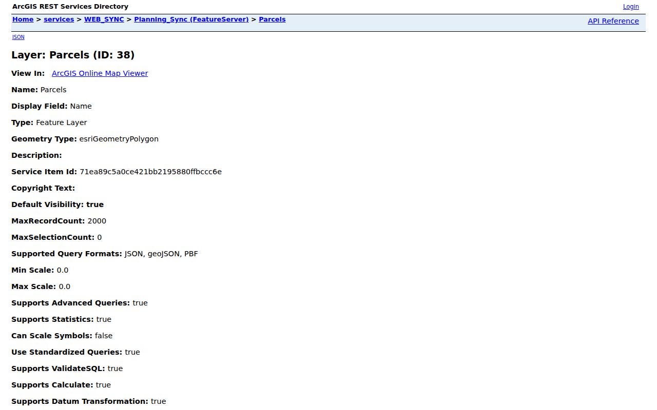
The City of Nacogdoches Parcels FeatureServer layer is a polygon service with advanced queries and JSON, GeoJSON, and PBF output. Its published fields include parcel_id, account, owner or name, property and mailing addresses, ZIP fields, legal descriptions, lot or tract references, land use, value fields, and geometry. Querying by street, ZIP, parcel ID, or geometry can place records along the same road without turning the map into a resident list.
The city parcel layer shows why a map result needs follow-up. It separates a property address from a mailing address and provides a parcel shape, but it does not establish who occupies a building. The parcel-layer source shows the fields and query capability used for this Nacogdoches street directory search.
View the published fields on the City of Nacogdoches Parcels FeatureServer before treating a map label as a record conclusion.
The Nacogdoches County ArcGIS gallery adds an Appraisal District Property Map, a County Address Verification Page, precinct maps, and a road map. County GIS and 911 addressing are useful for rough location work. Their disclaimer is equally important: the map is approximate, carries no accuracy guarantee, and is not proof of ownership or a legal boundary.
Nacogdoches Address Record Coverage
Different address records answer different questions. The appraisal district supplies parcel and tax context. The city map provides geography and published parcel attributes. The County Clerk connects instruments to parties and legal descriptions. A permit form or service route can identify a request path, but neither replaces a searchable history that the city has not published.
| Address record | Custodian | Useful fields | Access channel |
|---|---|---|---|
| Appraisal parcel | NCAD | Owner, property and mailing address, identifiers, legal description, values | Online search; district contact for corrections or current figures |
| City GIS parcel | City GIS | Polygon, parcel ID, situs, mailing, ZIP, legal, land-use fields | REST query and map layers, subject to disclaimers |
| Recorded instrument | Nacogdoches County Clerk | Grantor, grantee, number, date, type, legal description | GovOS index; copy request from the custodian |
| Older deeds | Texas State Library and Archives Commission | Volume and index entries, parties, legal description | Microfilm, interlibrary loan, or custodian route |
| Permit or service record | City Building Inspections and Code Enforcement | Address, owner, work, legal and lot fields where supplied | Permit form, Nac311, or city request route; no live citywide index found |
A record can be online, at a counter, or both. The County Clerk’s office remains the copy source for a certified recorded instrument. The local deed material listed by the state library covers 1835 through 1887, with index reels covering 1833 through 1871 and 1871 through 1893. That archival route matters because the official modern portal does not state a complete online start year.
Note: A result from one address-keyed source should be checked against its date, role, and legal description before it is combined with another source.
Nacogdoches Deed Paths by Address
The county-linked GovOS records index lets a searcher test grantor or grantee names, subdivisions, document types, document numbers, and recorded dates. It has both Search Index Only and Search Index & Full Text (OCR) modes. The portal instructions say that index searches can handle two or more words individually, while OCR phrase searching uses a phrase. During the inspection behind this research, the portal displayed county certification through August 30, 2026, but it did not publish an official searchable start year.
Use the parcel’s legal description at every step. If an older seller has several transactions, compare the recorded date, survey or abstract, subdivision volume or page, acreage, and instrument type. A street number can change after a subdivision, consolidation, or later addressing update. A legal description usually follows the land more reliably, though it can also change and should be reconciled rather than assumed.
- Parcel
- A defined unit of land in an appraisal or GIS system. Its identifier is not the same as a deed instrument number.
- Situs address
- The physical property address assigned to a parcel or improvement. It is distinct from a mailing address for tax correspondence.
- Plat
- A recorded map that can show a subdivision, lots, blocks, or easements. It can help interpret a legal description.
- Criss-cross directory
- An address-to-name directory format when a volume supplies one. No complete digitized Nacogdoches run was located, so confirm a volume and year with the repository.
Nacogdoches Address Geography
Nacogdoches is both a city and the county seat. A county record can therefore concern a rural community, a city parcel, a courthouse matter, or a historic jurisdiction. The property address in the city parcel layer identifies the physical place. The mailing address identifies where property correspondence is sent. A postal address routes delivery. None of those fields, alone, says who is physically present at a house.
The city permit application shows the details that can be requested for an address: address, date, permit type, legal description, block, lot, subdivision, owner, mailing address, project description, and valuation. The public sources did not reveal a searchable citywide permit archive. Nac311 and Code Enforcement provide reporting and contact routes, not a complete historical case index. A careful request should identify the address, date range, and record type sought under the Texas Public Information Act, Government Code Chapter 552.
Nacogdoches Historical Street Maps
Older addresses need a date attached to them. The TSLAC Nacogdoches map catalog includes an 1846 city plan and later records from 1961 through 1991. The SFA preservation study identifies Sanborn map years from 1885 through 1927. Maps can show block form, structures, use, materials, and change over time. They cannot name an occupant by themselves.
Pair a map with an instrument, a directory page, or a newspaper notice. The same approach helps when an old street name or historic lot does not fit the current parcel display. Dated directories and phone books belong to the Nacogdoches Directory Book; use the repository’s year and page as part of every historical address note.
Nacogdoches Street Directory Limits
A Nacogdoches street directory can show a public parcel record, a recorded transaction, or a dated historical entry. It cannot reliably show every person connected to an address. The public voter portal is an individual lookup, not a street roster. City GIS geometry is approximate, and an adjacent parcel is a geographic relationship, not a household or social relationship. The county record index may also include parties, heirs, agents, and former owners who do not live in the city.
When an access point has no public search, use its documented route instead of guessing. Ask the County Clerk about a copy, contact the appraisal district for corrections or current figures, confirm repository holdings before a visit, and direct a city request to the custodian that maintains the record.