
Nacogdoches Neighbors by Parcel
A block search in Nacogdoches should identify adjacent parcels first, then keep ownership, occupancy, and community context separate. The City parcel service publishes geometry and fields for an owner or name, property address, mailing address, legal description, ZIP, acreage, land use, and values. Its map is not proof of ownership and does not establish who occupies a structure. The Nacogdoches Central Appraisal District is a second property source, while historical repositories add dated rather than current context.
| Source | What It Shows About a Block | Access |
|---|---|---|
| City parcel FeatureServer | Parcel polygons, parcel ID, property and mailing fields, legal description, ZIP, land use, and values | Queryable public layer and map data; geometry disclaimers apply |
| NCAD appraisal search | Tax-appraisal owner or name field, address, identifiers, legal description, tax year, and value fields | Online property search; ask the district about corrections |
| County Clerk index | Recorded instruments, grantor and grantee roles, dates, document types, and legal descriptions | Online index; County Clerk supplies copies and certification |
| State association search | Public association-management certificate details for a named association | Name, county, city, or ZIP filters and certificate PDFs |
| Historic records | Dated directory, map, newspaper, or archive context for a block | ETRC, TSLAC, library, and archive routes |
These sources do not make a roster of Nacogdoches neighbors. A parcel may be vacant, institutional, commercial, tax-exempt, or connected to a mailing address elsewhere. Treat each result as a source-specific fact. The official County Clerk record index can help explain a deed or legal description, but an instrument name is a recorded role, not proof of present occupancy.
Nacogdoches Adjacent Parcel Method
The City of Nacogdoches parcel FeatureServer is a polygon layer that supports advanced queries and JSON, GeoJSON, and PBF output. Find the starting parcel by an address or parcel ID, inspect its polygon, then browse or query the touching and nearby polygons. The most careful description is “adjacent parcel IDs,” followed by separate inspection of each parcel's published fields. A radius or buffer shows proximity only. It does not create a social, household, or family relationship.
- Locate the starting address or parcel ID in the city layer and record the property address, mailing address, legal description, and parcel identifier.
- Inspect the surrounding polygons and list only the parcel IDs that touch or sit near the starting geometry.
- Open each adjacent parcel separately and preserve the source date, owner or name field, property field, mailing field, land use, and legal description.
- Use NCAD to compare appraisal fields, keeping a tax-appraisal name separate from a claim of occupancy.
- Where a transfer matters, check the County Clerk index by the legal description or name and request a copy from the custodian if needed.
For a full named-street record chain rather than the immediate block, use the Nacogdoches Street Directory. Its address workflow is the better route for tracing a whole street across appraisal, GIS, and recorded-instrument sources.
Nacogdoches Neighbors and Address Fields
Property and mailing fields answer different questions. A situs or property address is the physical location assigned to the parcel or improvement. A mailing address is where tax or property correspondence is sent and may be elsewhere. The City layer keeps those field groups separate, along with ZIP and legal-description fields. A postal ZIP is delivery geography, not a city-limit, voting-precinct, neighborhood, or household boundary. This distinction is central when comparing Nacogdoches neighbors around one block.
- Parcel
- A mapped unit of land identified by a local tax or GIS system. Its boundary can be generalized and is not a legal boundary determination.
- Situs address
- The physical address attached to a parcel or improvement in a property system.
- Mailing address
- The correspondence address in a property record. It can differ from the situs and does not prove residence.
- Legal description
- The lot, block, subdivision, survey, acreage, or other land description used to distinguish property.
The Nacogdoches County ArcGIS gallery adds appraisal, address-verification, precinct, and road-map context. County map notices say the information is approximate and is not a warranty of ownership. Use it to orient a search, then verify a key detail with the source that owns it.
Nacogdoches Neighbors Association Records
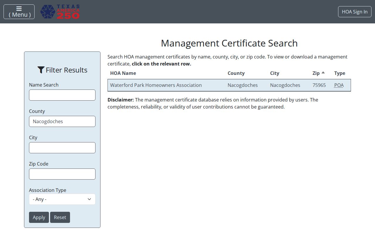
Association material is a community-management source, not a household list. The Texas management-certificate search accepts name, county, city, and ZIP filters and returns certificate PDFs. During research, Waterford Park Homeowners Association appeared as a Nacogdoches County result with city Nacogdoches and ZIP 75965. Open a certificate and check its effective date before relying on the result.
| Public association route | What it can confirm | What it cannot confirm |
|---|---|---|
| Texas HOA management-certificate search | Association name, county, city, ZIP, search fields, and an available certificate PDF | Membership, ownership, household identity, or who lives at a parcel |
| Nacogdoches Chamber directory | Public organization listings by keyword, category, or alphabet | An organization's current members or a residential block roster |
| ETRC community collections | Historical church, family, reunion, oral-history, and local-life material with repository context | Current contact details or modern household relationships |
The filtered association-certificate search is the public access point found for this record type.
A current City of Nacogdoches neighborhood-association directory or umbrella council page was not located in the research. Use the state certificate search for an association document, the Nacogdoches Chamber directory for public organization contacts, and the appropriate official contact route for a current list rather than inferring one from a certificate.
Nacogdoches Neighbors in Historic Blocks
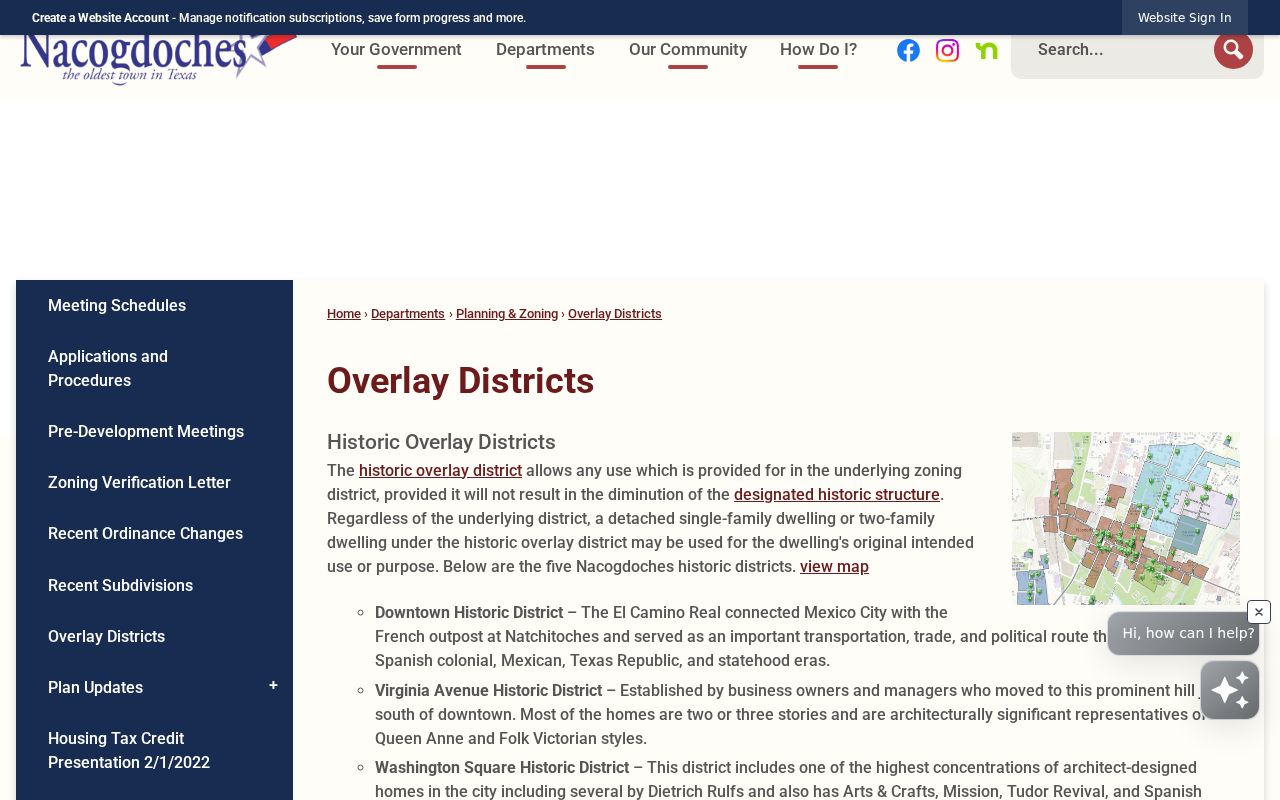
Historic district boundaries offer a geographic layer for Nacogdoches neighbors without claiming a present-day social group. The City's overlay material names Downtown, Virginia Avenue, Washington Square, Zion Hill, and individually designated Outside Historic District properties. Downtown follows the historic commercial core. The Washington Square description places it along North Mound from Hospital to Houston and says it adjoins Zion Hill. These are place facts, not evidence that every parcel resident shares an association or identity.
The City's historic overlay districts page provides the public boundary and preservation context for this part of a block search.
Historic overlays also explain why a block can have a distinct map or architecture story. Exterior work in an overlay requires a certificate of appropriateness. For an older address, pair the district description with the TSLAC map catalog and the SFA Sanborn sources, then cite each source's period instead of projecting an old lot pattern onto a current parcel.
Nacogdoches Neighbors Source Types
Official records and commercial neighbor-search categories serve different purposes. Official sources show the fields and limits set by their custodians, often with a parcel, instrument, case, or repository identifier. Commercial compilations can combine public filings, address histories, marketing data, and licensed feeds. They may charge for access, merge people with similar names, retain old addresses, or omit protected and corrected material. Neither category should be used as a substitute for a direct, dated record from the proper custodian.
| Category | Useful for | Limit to keep in view |
|---|---|---|
| Official parcel and deed sources | Published parcel fields, legal descriptions, recorded roles, and copy requests | They do not establish occupancy or a social relationship |
| Official self-service voter route | A voter's own registration and polling information | It is not a block-browsing tool; protected fields and addresses apply |
| Commercial compilation category | A possible research lead requiring source-by-source checking | Stale or merged information is not a certified or authoritative record |
The Texas My Voter Portal takes name, county, date of birth, and ZIP for self-service registration and polling information. Texas rules restrict phone, driver-license, state-ID, Social Security, and certain protected address information. Do not turn a voter route into a list of Nacogdoches neighbors.
Nacogdoches Neighbor Privacy Limits
Public sources have hard boundaries. Parcel data may show a published owner or name field, but it does not identify every person at an address. Utility and motor-vehicle data are not substitutes for a block directory. A renter, visitor, household member, protected voter, or Address Confidentiality Program participant may be absent or represented by protected information. A map edge, mailing field, or historical directory entry also cannot prove a current personal relationship.
Lawful use. Use Nacogdoches neighbor information for personal, lawful place research, community history, estate questions, or checking a public record. Do not use it to watch, harass, intimidate, or harm anyone.
The Texas Address Confidentiality Program gives eligible participants a substitute mailing address and mail-forwarding service. The Texas voter confidentiality page explains limits on protected voter information. Respect an absence or redaction rather than seeking to reconstruct it from nearby records.
Nacogdoches Block Request Fallback
If a parcel, map, association, or historic source does not answer the question, ask the custodian for a specific record rather than a people list. Give an address, parcel ID, legal description, date range, instrument number, or historic district name. The Texas Public Information Act overview directs requests to the governmental body that maintains the record and explains the response process. Requests for records with protected fields can be narrowed or redacted under applicable law.
Use the County Clerk for deeds and recorded instruments, NCAD for appraisal corrections, City GIS for layer context, and the state association search for management certificates. For a historic block, the ETRC community digital collection, Texas State Library maps, and the library or archive can add a dated item, photograph, or map. Cite the repository, item title, date, and collection, then keep historical evidence separate from a claim about who lives nearby now.
Note: A narrow request with an address, date range, and record type is easier for a custodian to route than a broad request for neighborhood identities.