
Nacogdoches ZIP Code Delivery Coverage
Nacogdoches postal coverage is a working map, not a resident roll. The Texas geographic-code list identifies 75961, 75962, and 75963, while USPS-derived descriptions and postal tables also show 75964 and 75965 for Nacogdoches. The research supports using all five as working routes for city-focused research, then confirming a particular address through USPS or the city GIS. The sources inspected do not publish a neighborhood-by-neighborhood allocation or a named post office for every route, so the table keeps that uncertainty visible.
| ZIP | Areas Covered | Post Office | Notes |
|---|---|---|---|
| 75961 | Standard Nacogdoches delivery | Confirm by address with USPS | General city route; exact placement needs an address-level result. |
| 75962 | Unique Nacogdoches route associated with Stephen F. Austin State University | Confirm by address with USPS | Institutional route, not a campus resident list. |
| 75963 | Nacogdoches PO Box delivery | PO Box route | A box route is not necessarily a physical address. |
| 75964 | Standard Nacogdoches delivery | Confirm by address with USPS | Use USPS verification and city ZIP mapping. |
| 75965 | Standard Nacogdoches delivery | Confirm by address with USPS | Useful as a local geographic filter where a source provides one. |
The distinction matters. A ZIP can serve an address beyond a city line, a university-centered route can represent an institution rather than a neighborhood, and a PO Box can receive mail without revealing a site. A USPS ZIP Lookup result confirms delivery routing for the submitted address. USPS specifically says that result never confirms a person or business at that address.
Nacogdoches Postal Route Types
ZIP routes are delivery tools, so they do not all describe the same kind of place. Standard delivery routes such as the Nacogdoches working routes can be checked against a street address. ZIP 75962 is a unique route associated with Stephen F. Austin State University, while 75963 is a PO Box route. This difference is why a ZIP match should be paired with a second key, such as a complete address, an organization, a parcel identifier, or a date-specific public record.
Postal names and city names can also differ from municipal boundaries. A postal result can be accurate for delivery and still fail to establish a city limit, voting area, parcel boundary, affiliation, or occupant. The strongest Nacogdoches postal result states exactly what was checked: a postal route, a city GIS polygon, an address field, or a record source with a ZIP filter.
Note: Do not treat a unique route or PO Box ZIP as a map of households, apartment units, or current residents.
Map Nacogdoches ZIP Code Fields
The City ZIP FeatureServer is a polygon layer titled Zip Code. It is useful for mapping the postal geography inside the city GIS environment and checking whether a location falls in a mapped municipal ZIP area. It is not a person-search form. Its fields document the postal and governmental labels attached to a polygon, while the geometry shows an approximate mapped area rather than a legal city boundary.
The City ZIP FeatureServer provides the published Nacogdoches postal geography and field inventory.
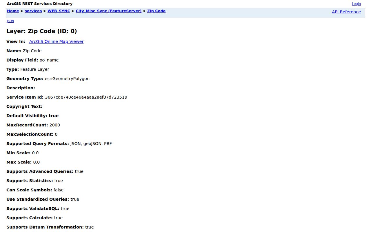
The layer is most useful after an address or other record key has narrowed the geographic question to a particular part of Nacogdoches.
The published fields below are a search inventory, not a collection of names or addresses.
| zip5 | Five-digit ZIP value for the mapped polygon. |
|---|---|
| po_name | Published postal-name field. |
| county | County attribute attached to the ZIP polygon. |
| cnty_fips | County FIPS-code field. |
| zipcode | Additional ZIP-code field in the service schema. |
| city_cd | City-code field used in the service. |
| globalid and shape | Service identifier and polygon geometry, with created and edited fields also observed. |
Search Nacogdoches Records by ZIP Code
A ZIP can narrow a Nacogdoches search when it is combined with another supported field. Start by verifying the postal route, then decide whether the question is about an address, a mapped area, a public association certificate, an individual voter lookup, or a license record. The inspected sources did not identify a first-party Nacogdoches parcel or person search that accepts a ZIP alone. That absence is important because it prevents a postal search from becoming a claim that all people in a postal area can be listed.
- Use the USPS address mode, city-and-state mode, or cities-by-ZIP mode to check the postal route for the address or place being researched.
- Inspect the City ZIP FeatureServer to see the ZIP polygon and its postal, county, and city-code fields in the local GIS environment.
- When an address or owner name is already known, use the Nacogdoches Central Appraisal District property search and retain the property or mailing ZIP fields returned with that record.
- For an individual voter question, use the Texas My Voter Portal with its name, county, date-of-birth, and ZIP inputs. It is not a ZIP-wide browser.
- State the result narrowly: postal routing, mapped ZIP geography, or a field on a separate record. Do not convert it into a statement about who lives in the area.
Once a verified ZIP has been narrowed to a street and address, the Nacogdoches street directory supplies the address-focused route without treating postal geography as a complete address list.
Nacogdoches ZIP Code Source Limits
Different official tools handle ZIP information in different ways. The NCAD visible search form did not show a ZIP input, even though the resulting parcel data can contain zip5 and zip4 fields. The city ZIP layer maps geography. A ZIP field in another system only does the job that system documents. For example, association certificates and license databases can offer geographic filters, while an individual voter lookup has different access limits and protected fields.
| Source Type | ZIP Field or Output | Nacogdoches Use | Limit |
|---|---|---|---|
| Postal address lookup | Street address plus city/state or ZIP; city/state-to-ZIP; cities-by-ZIP | Verify delivery routing for a submitted address | Does not confirm a person or business. |
| City ZIP polygon service | zip5, postal name, county, FIPS, ZIP, city code, polygon | Map a ZIP area in city GIS | Not an open person-search form. |
| Appraisal result | zip5 and zip4 among address fields | Check postal fields after an owner or address search | No direct ZIP input was observed. |
| Association certificate search | County, city, and ZIP filters | Locate public Nacogdoches association certificates | A certificate is not a membership list. |
| Professional-license search | City, county, ZIP, and ZIP-range filters | Narrow an official license record by geography | Only covers the board's published license records. |
The Texas HOA management-certificate search accepts county, city, and ZIP filters, and the Texas State Board of Dental Examiners public search supports city, county, ZIP, and ZIP-range filters. Each source has its own scope. A ZIP field can narrow a legitimate record search without proving a private household connection.
Nacogdoches City Limits and ZIPs
A Nacogdoches ZIP boundary does not automatically match the city limit, county line, neighborhood, voting precinct, or parcel line. Postal delivery, municipal boundaries, and GIS layers are maintained for different purposes and can change on different schedules. The research did not identify exact local addresses where a ZIP crosses the city line, a ZIP split or realignment year, or per-ZIP population and registration totals. The accurate statement is limited: 75961 through 75965 are Nacogdoches postal routes shown by the inspected sources, and exact placement needs USPS or GIS verification.
Nacogdoches is both a city and the county seat, so a record described as local can be city-centered, countywide, campus-centered, or rural. Keep the jurisdiction alongside the ZIP. That simple step avoids calling a county record a city record merely because its mailing city is Nacogdoches.
Nacogdoches ZIP Code Definitions
Postal terms can look similar while answering different questions. These short definitions keep a local ZIP search focused on routing and geography rather than assumptions about an address or person.
- ZIP
- The five-digit postal routing code used to sort and deliver mail for an address or route.
- ZIP+4
- The five-digit ZIP plus four extra digits that USPS uses to refine delivery sorting for a narrower address range or delivery point.
- PO Box ZIP
- A ZIP assigned to post-office box delivery. It does not, by itself, identify a physical parcel.
- Unique ZIP
- A ZIP that can serve a high-volume entity or institutional route, such as the SFA-associated 75962 route.
- Carrier route
- A mail-delivery grouping within postal operations. It is not a city boundary or a list of occupants.
Use the complete printed address when possible. A ZIP+4 or a carrier route can improve delivery precision, yet it still cannot confirm the person, organization, or parcel associated with the address.
Nacogdoches ZIP Code History Caution
ZIP fields belong to modern postal geography and should not be projected backward onto older Nacogdoches records. For an address from before ZIP codes, use the street form printed in a dated directory, phone book, newspaper, map, or record index. Then compare that dated form with a current parcel or city layer only after recognizing that streets, lots, and city limits may have changed.
Historic maps and city directories answer place and date questions more directly than a modern ZIP. When a historical address needs a current street-level check, preserve both forms of the address and use the current parcel or mapping source as a separate modern reference. That distinction keeps the postal layer, the property layer, and the historical layer from being blended into one unsupported result.
Note: A verified ZIP is a useful geographic filter, but a second source is needed before drawing conclusions about any person or address.